
Kiev is not just the capital of Ukraine; it is – the heart of the country, a city with a rich history and unique cultural heritage. Its past began long before it was officially mentioned in chronicles and legends.
Archaeological findings indicate that the territory of modern Kiev was inhabited 15,000 to 20,000 years ago. However, Kiev as a city began to take shape much later, with the arrival of the first Slavic settlements.
 7
7 According to legend, Kiev was founded by three brothers – Kyi, Shchek, and Khoriv, along with their sister Lybid. The city got its name in honor of the eldest brother, Kyi. The legend suggests that the location for the settlement was chosen deliberately: the hills on the right bank of the Dnieper provided natural protection, turning Kiev into an impregnable fortress. These lands, situated on the right bank, formed the core of the ancient city, becoming its historical and cultural center. The left bank of the Dnieper remained largely detached from urban life for a long time. Historically, it was less populated, characterized by rural areas and pastures. The incorporation of the left bank territories into Kiev began only during the Soviet period, amid active urbanization and the construction of high-rise residential blocks. This transformed the left bank into a primarily residential area, while the right bank maintained its status as a business and cultural hub.
8 Despite the differences in development, both banks of Kiev have their unique features. The right bank preserves historical landmarks, such as Andriyivskyy Descent, Volodymyr Hill, and St. Sophia Cathedral, while also offering a variety of cultural establishments. The left bank, in turn, showcases modern architecture, spacious parks, and atmospheric locations for relaxation. This symbiosis creates a unique urban character.
9 Such differences between the right and left banks often lead to jokes and stereotypes. For instance, Podil is associated with a creative and hipster environment, whereas Troieshchyna has garnered stereotypes related to "hooligans." Of course, there is no real conflict between the residents of the banks, but stereotypes often distort perceptions of the areas, solidifying simplified and sometimes unrealistic images. These patterns, while serving as a basis for humor and memes, can sometimes hinder the recognition of the true diversity and richness of each district.
The Roots of the Right Bank
 0
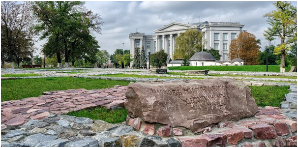
0 The right bank of Kiev, the historical center of the city, was initially populated due to its advantageous geographical location. The hills where Kiev emerged provided natural defensive barriers, and the Dnieper offered access to trade routes. From the 6th century, the first settlements of the Slavic tribe of Polans appeared here. The main fortification, known as the detinets, was located on Starokyivska Hill, where today stands a monument to Prince Volodymyr.
1 From the 9th century, Kiev became the center of Rus. During this period, a crafts and trade settlement developed in Podil, attracting merchants from various countries, including Byzantium and Khazaria. The 11th century marked a time of flourishing for Kiev. Prince Yaroslav the Wise promoted the construction of the Golden Gates and St. Sophia Cathedral, while the Pechersk Lavra, founded in the mid-11th century, became one of the largest monastic centers in Eastern Europe.
During the Mongol invasion, Kiev suffered greatly but gradually recovered, maintaining its status as an important religious and administrative center. In the 14th-15th centuries, the city became part of the Grand Duchy of Lithuania and later the Polish-Lithuanian Commonwealth. During this time, Kiev continued to grow, especially in the Pechersk and Podil areas, where numerous churches and artisan workshops were built.
2 3 The 18th century was marked by the construction of outstanding architectural monuments, such as St. Andrew's Church and the Kyiv-Mohyla Academy. With the onset of industrialization in the 19th century, the right bank of Kiev experienced an economic boom. The construction of the railway and the introduction of the Kyiv tram significantly improved infrastructure. The first factories, workshops, and plants began operating in Podil and Pechersk, attracting a workforce and contributing to urbanization.
During the Soviet period, the right bank became the administrative and cultural center of Kiev. New residential districts, such as Shevchenkivskyi and Solomianskyi, were built in place of historical neighborhoods, and industrial zones developed. In the 1960s, the construction of the metro began, connecting the right bank to the left, solving transportation issues.
4 Indeed, the right bank is the center of urban life. Key landmarks such as Sophia Square, the Golden Gates, Podil, and many others closely link the present with the past. At the same time, the right bank hosts office centers, universities, restaurants, cultural spaces, and the main administrative institutions.
The Historical Development of the Left Bank
5 The left bank has a different story. Historically, people began to settle this area in the 11th century. At that time, there were vast meadows, forests, and numerous water bodies: Rusanivske Lake, Darnytske Lake, Telbin, as well as rivers such as Pozniakivka, Raidunka, and others. However, settlement occurred quite slowly, as the low-lying areas of the left bank often flooded during the Dnieper's overflow, preventing the establishment of permanent settlements.
The situation began to change in the Middle Ages when the lands of the left bank started to come under the jurisdiction of monasteries – Mykolaivskyi, Pecherskyi, Vidubitskyi, Bratskyi, and others. To exert influence over as many peasants as possible, each monastery established slobodas – settlements that were fully exempt from taxes and obligations for periods ranging from 5 to 15 years. Thus, from the 16th century, the population of the left bank began to grow.
6 However, true development began after the reform of 1861. Besides agriculture, the first artisan workshops started to emerge on the left bank, and its proximity to Kyiv's markets and fairs allowed peasants to achieve a more or less stable income. In 1870, the Darnytskyi Railway Bridge over the Dnieper was opened, also known as the Struve Bridge (the bridge suffered damage three times: during the Polish-Soviet War and World War II – during the retreat of Soviet troops from Kyiv, but it sustained the final blow during the retreat of the Nazis in 1943. The Struve Bridge could not be restored, and thus the Darnytskyi Bridge was constructed in 1951).
Another significant moment occurred in 1923: following an administrative reform, the majority of the left bank, which had previously belonged to Chernihiv Governorate, was annexed to Kyiv. However, urbanization only began during the Soviet period when the left bank started extensive development.
7 To address the housing crisis in Kyiv, large residential areas such as Rusanivka, Berezniaky, and Troieshchyna began to be constructed in the places of former slobodas and meadows. The construction took place on reclaimed lands, strengthened to protect against Dnieper floods. For example, Rusanivka, with its picturesque canals and fountains, was envisioned as the "Venice of Kyiv."
The population increased, and the left bank gradually transformed from a rural outskirt into an integral part of the capital. In the 1970s, a metro line was extended to the left bank of Kyiv, new bridges were built, and a rapid tram service started operating in Troieshchyna.
8 Today, the left bank of Kyiv consists of three districts: Darnytskyi, Dniprovs'kyi, and Desnians'kyi. These districts are characterized by a calm atmosphere, a result of Soviet-era development. However, the left bank is also known for its green spaces, such as Trukhaniv Island and Hydropark. Troieshchyna has become the largest residential area in Kyiv, where infrastructure is actively developing, while Darnytsia combines modern skyscrapers with preserved private houses, reminding of its past.
Friendly Rivalry
It should be noted that there is no specific conflict between the banks of Kyiv; however, stereotypes exist that influence the formation of collective perception.
Essentially, they arise as simplifications and serve as quick references for people, facilitating adaptation in different social conditions. In other words, it is easier for us to perceive something through the lens of a familiar category. However, this simplicity often leads to distortions, contributing to the emergence of certain "truths."
Constructed stereotypes can sometimes border on humor, which helps to alleviate stress levels. However, humor in this context plays a dual role. On one hand, it can soften the sharpness